Compact and lightweight
High-performance scanner
Leave the jobsite with confidence and precise scans every time. Our advanced 3D laser scanning technology provides high-resolution 3D data for accurate building construction, verification, and a wide array of geomatics applications.
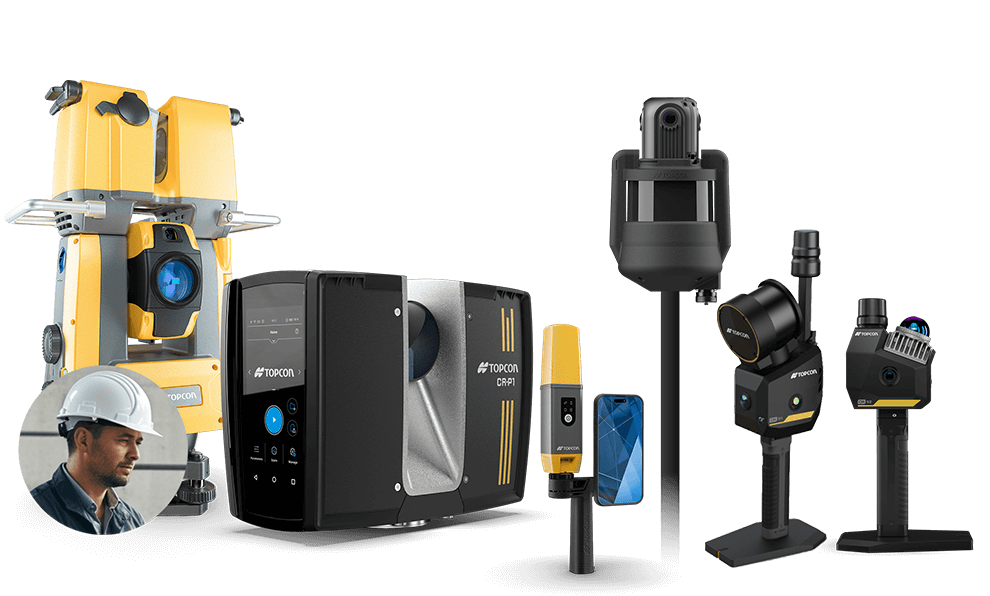
Capture Reality Products
Identify the Perfect Solution for Your Scanning Operations.
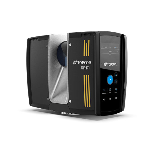
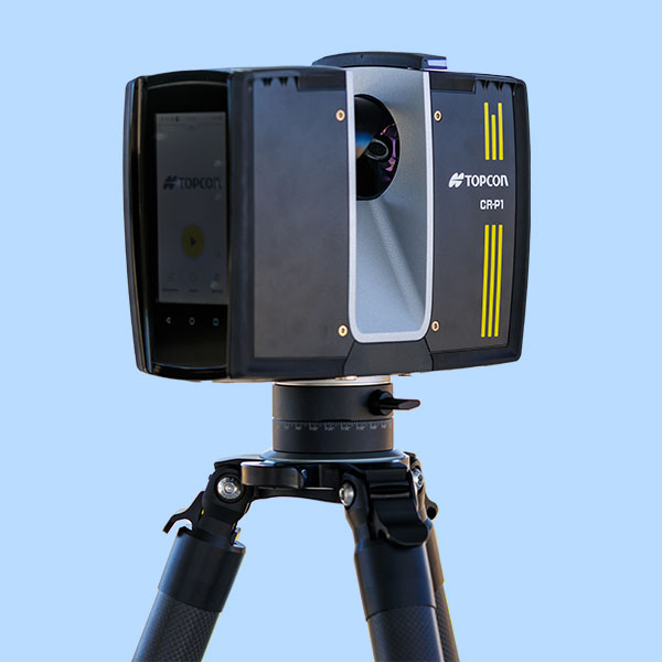
CR-P1
Description
Ideal use
Real-time scan registration and real-time complete dataset processing
Scan range (90% Reflectivity)
CR-P1 100: 100 m / 330 ft
CR-P1 200: 200 m / 655 ft
Field of view
V: 300° / H: 360°
Scan data rate
2,000,000 pts per second
Laser Class
Class1
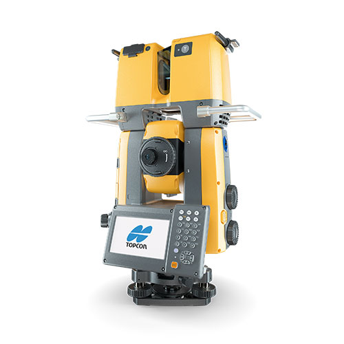
GTL-1200
Description
Robotic total station with integrated laser scanner
Ideal use
Construction verification, scanning, site and field survey, layout, staking, Hybrid Positioning™
Scan range (90% Reflectivity)
70 m
230 ft
Field of view
V: 270° / H: 360°
Scan data rate
200,000 pts per second
Laser Class
Class1
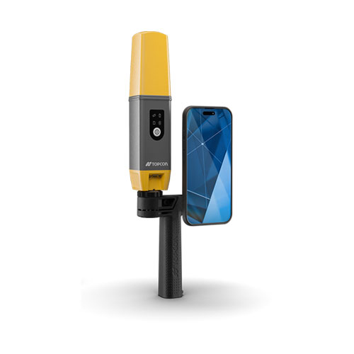
CR-H1
Description
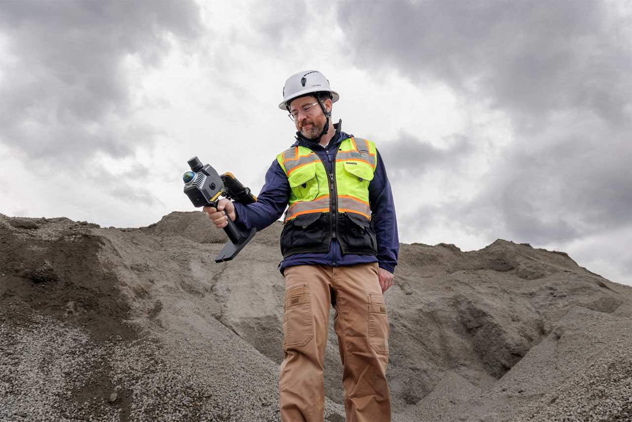
Hand-Held Mobile Scanner
Ideal use
Utilities and subsurface mapping,
Construction verification and Earthworks,
Stockpiles
Civil Engineering and site verification
Scan range (90% Reflectivity)
10 m
33 ft
Field of view
V: 360° / H: 360°
Scan data rate
Depends on the phone model
Laser Class
Class1
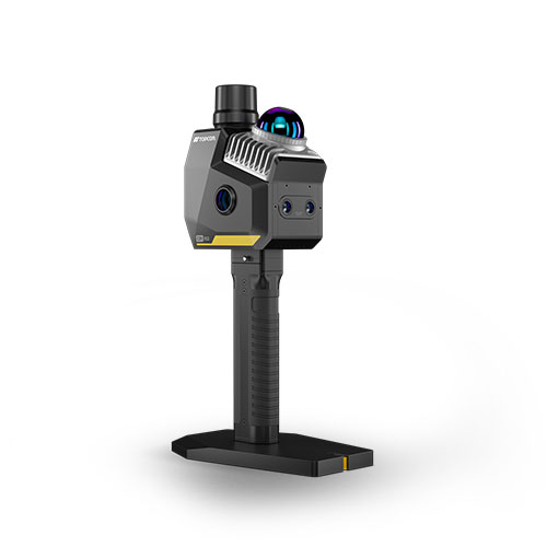
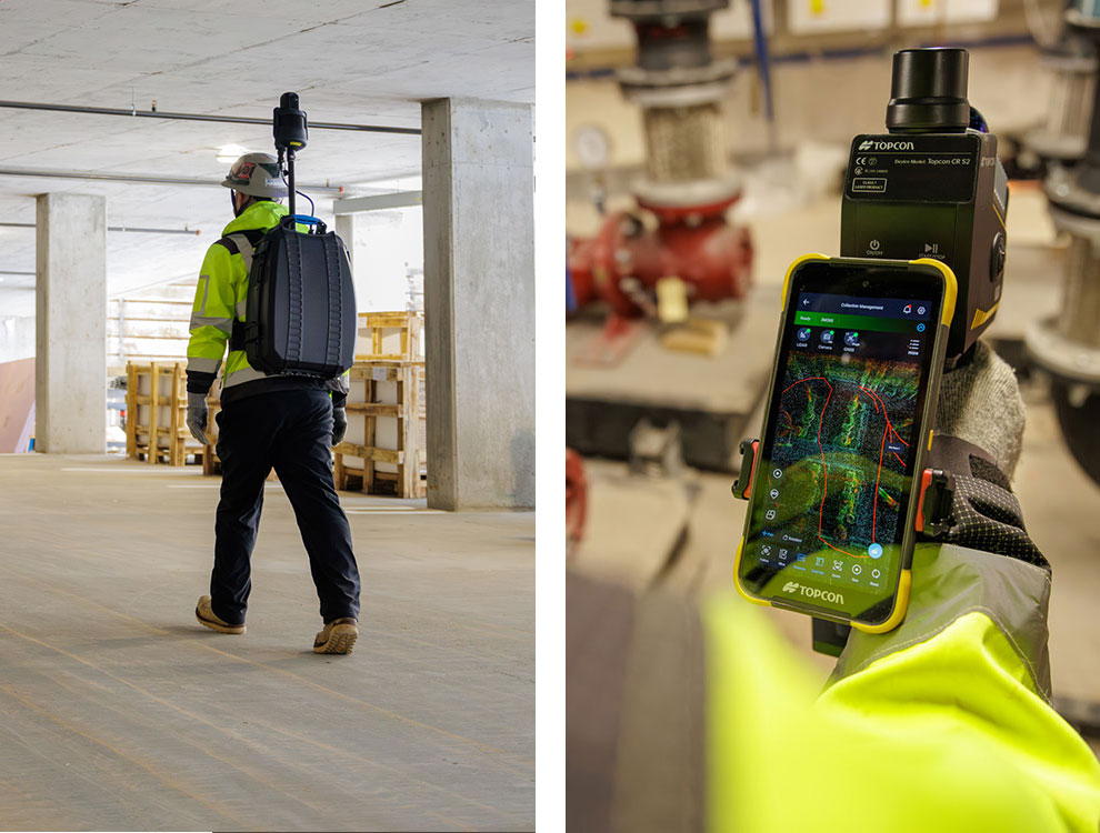
CR-S2
Description
Hand-Held Scanner with VSLAM technology
Ideal use
Topographic mapping and geospatial data, Construction site surveys and progress monitoring, Infrastructure assessment and maintenance, Emergency response and disaster management, Dense forests or urban canyons
Scan range (90% Reflectivity)
70 m
230 ft
Field of view
V: -7 to + 52° / H: 360°
Scan data rate
200,000 pts per second
Panoramic cameras: 12MP ×2
VSLAM cameras: 1.3MP ×2
Laser Class
Class1
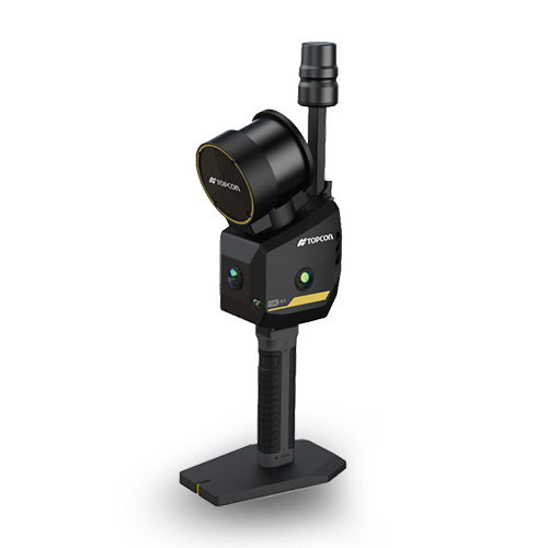
CR-S1
Description
Hand-Held Scanner with MLF-SLAM technology
Ideal use
Featureless environments such as airports, beaches, and rivers, Topographic mapping and geospatial data, Construction site surveys and progress monitoring, Infrastructure assessment and maintenance, Emergency response and disaster management
Scan range (90% Reflectivity)
120 m
393 ft
Field of view
V: 360° / H: 280°
Scan data rate
320,000 pts per second
Panoramic cameras: 12MP ×3
VSLAM cameras: 1.3MP ×2
Laser Class
Class1
CR-M1
Description
Compact and handy versatile multi-sensor mapping system for use with a backpack, on a pole or tip, or even on a vehicle
Ideal use
Digital twins, BIM, Construction, Facility management for multi-story buildings, Industrial plants, Mining, Tunneling, Heritage, Tourism
Scan range (90% Reflectivity)
120 m
393 ft
Field of view
V: 360° / H: 360°
Scan data rate
640,000 pts per second
360°-Panoramic camera: 4 lenses - 4K Ultra HD
Laser Class
Class1
How does it work?
Scan your environment
Select the right tool for the job. Our range of scanners allows you to perform high-density and high-speed scanning. Leverage high-resolution cameras for comprehensive site-wide scans and complete data capture.
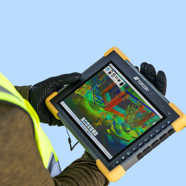
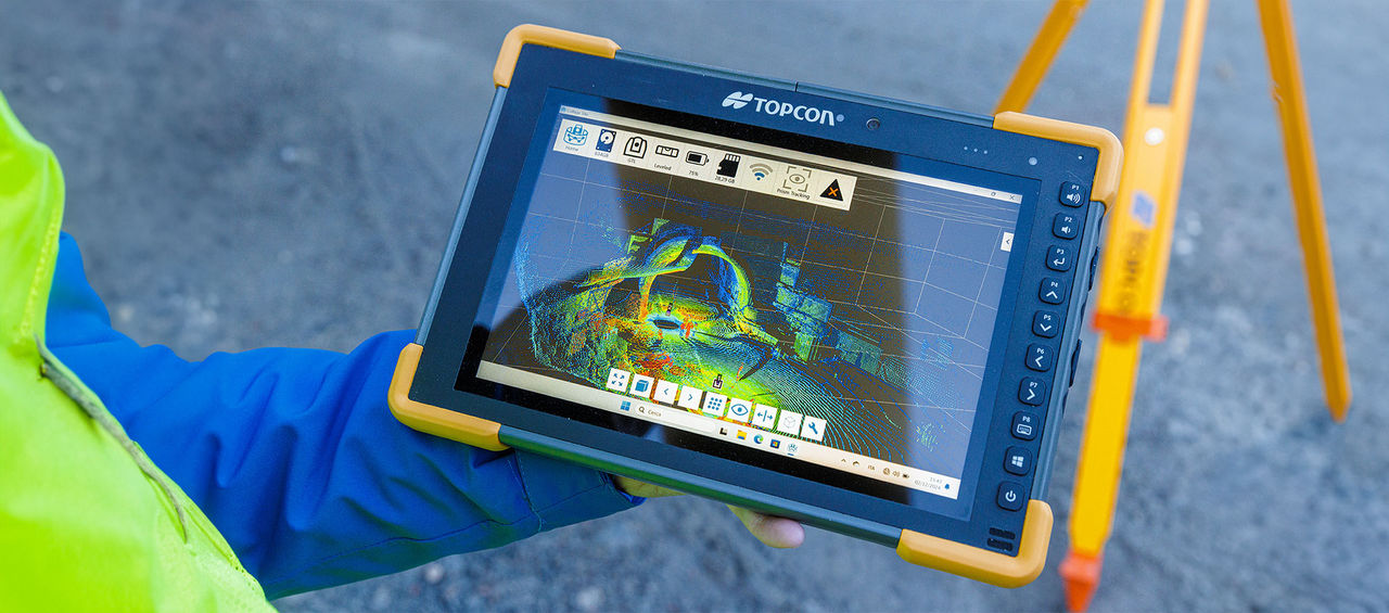
Process and register on-site
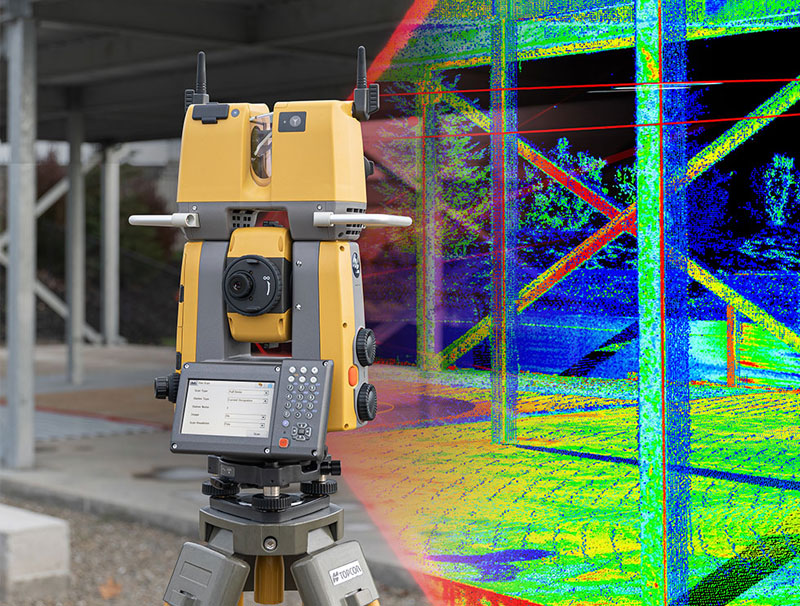
Use our field software to register and process your scans in real-time. With a terrestrial laser scanner, you can instantly verify data coverage and accuracy, ensuring you have a complete dataset before leaving the job site.
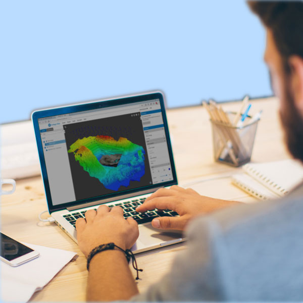
Analyze and deliver
Generate reports and perform volume calculations directly in the field. Export the registered point cloud or utilize innovative techniques like Gaussian splatting to create precise digital twins, BIM models, and other critical project deliverables.
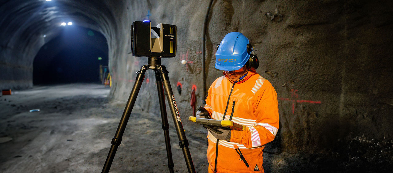
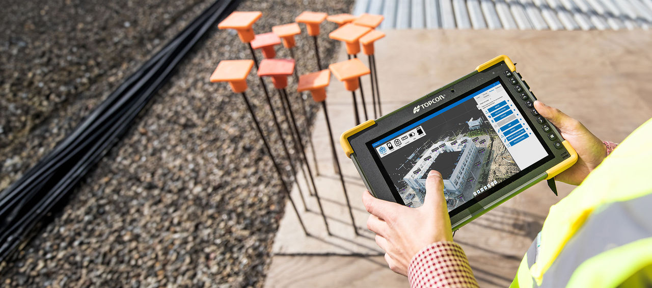
Boost Jobsite Efficiency with On-Site Registration
Capture up to 2 million points per second with 2mm accuracy, perform in-field scans, and process complete point cloud data effortlessly.
Capture Reality
Your comprehensive scanning solution
Automatically produce on-control scan data
Fully register in the field with no office support needed
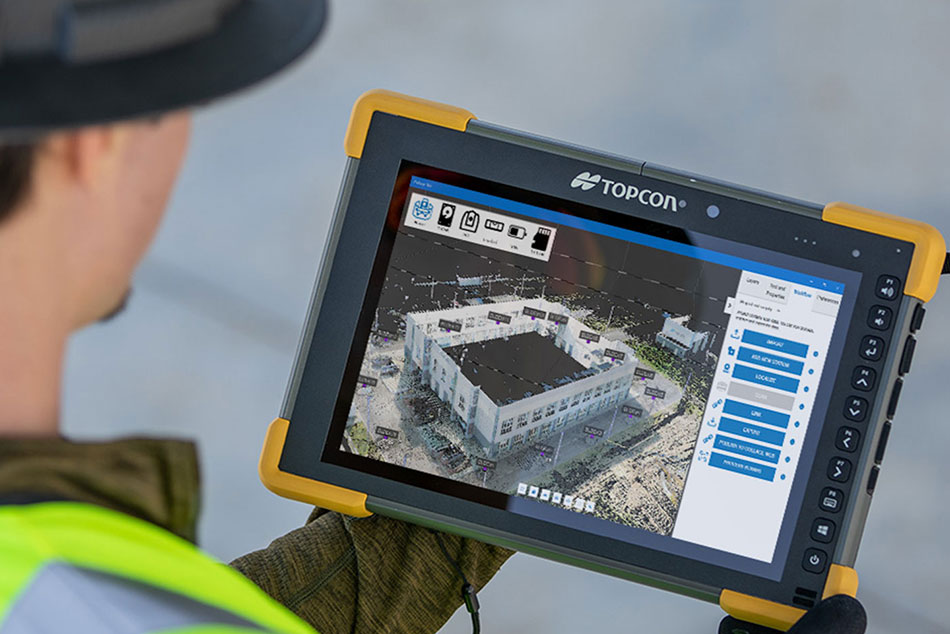
Visualize processed data in real time
Obtain in-field QA results, including visual heatmaps or detailed analysis with Verity and ClearEdge3D Tools
Communicate findings with stakeholders through the cloud using Collage Web
Capture Reality
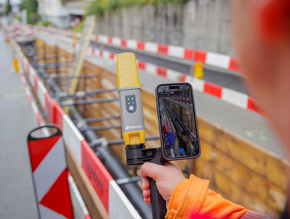
Photogrammetry with RTK accuracy
The Topcon handheld scanners make advanced workflows accessible to everyone.
Their intuitive, portable design combines RTK geolocation with real-time AR visualization and GeoSlam routines.
Our software ensures that all deliverables are provided in standard point cloud formats, guaranteeing compatibility and seamless integration into professional workflows.
Capture 3D point-clouds of jobsites in realtime as you walk, ensuring accuracy and delivering quick, precise volume calculations.
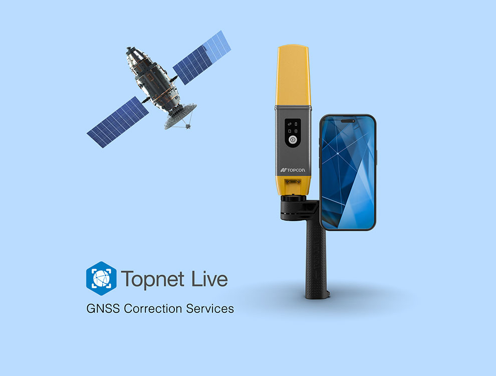

The CR-H1 handheld capture reality solution contains:
- HiPer CR GNSS receiver
- iPhone Pro or iPhone Pro Max*
- PIX4Dcatch and PIX4Dcloud subscription
- Network correction subscription (Topnet Live or other)
- Handle, also capable of attaching an antenna pole
*iPhone PRO / MAX – to be purchased separately
Unlock the full potential of your operations. Schedule a demo with our scanning technology experts and discover how our solutions can drive measurable impact.
Capture reality. With enhanced software.
Boost productivity with our integrated software for 3D laser scanning. Automate modeling, simplify verification, and manage complex QA workflows for near real-time results.
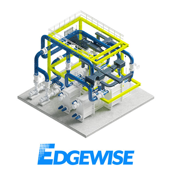
Accelerate projects with ClearEdge3D EdgeWise: This clever tool rapidly extracts model geometry from point clouds, allowing you to complete work with greater speed and accuracy compared to manual methods.
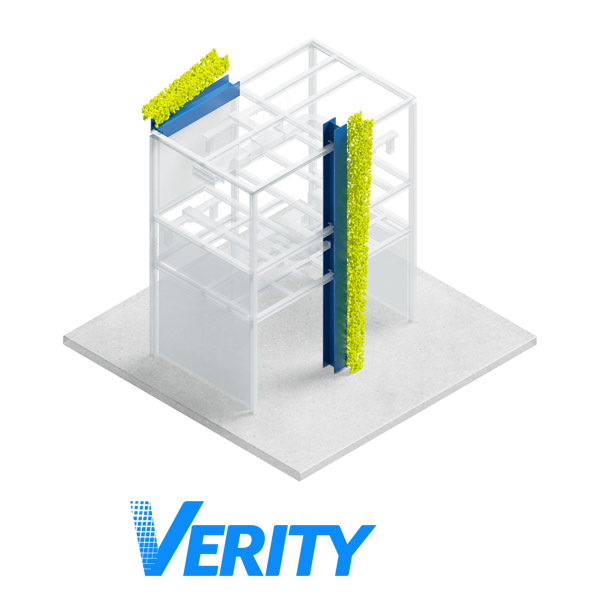
Avoid costly errors with ClearEdge3D Verity: As an automated construction verification and QA/QC tool, Verity compares as-built point clouds to models in Autodesk Revit and Navisworks, identifying mistakes up to 85% faster than traditional methods.
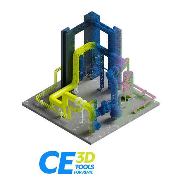
Manage point cloud data effortlessly with ClearEdge3D Tools for Revit: These purpose built, user-friendly tools enhance Revit’s as-built modeling capabilities, helping you unlock new level s of efficiency.
Related offerings


Get in touch
Thank you! We will be in touch.