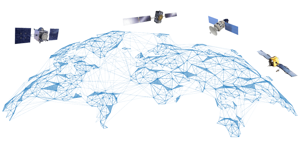
The Topcon reference station network uses five GNSS satellite systems: GPS, GLONASS, Galileo, QZSS, and BeiDou. This ensures the best global coverage, accuracy, and reliability.
Services for wherever work takes you
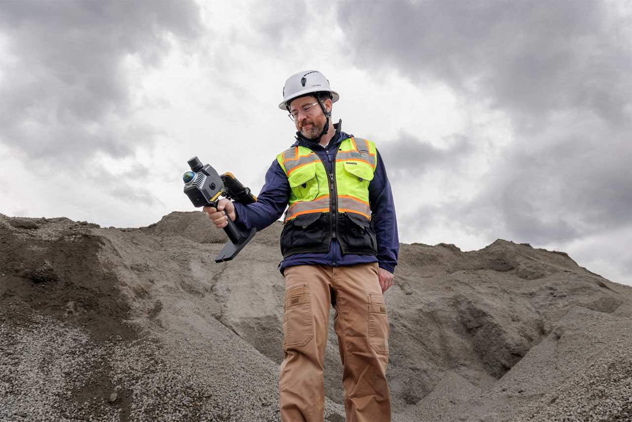
Topnet Live is a global GNSS correction service that delivers positioning data to surveyors and construction teams whose projects use satellite positioning. Roving surveyors and construction workers, along with heavy construction equipment with satellite navigation systems, use this service for high-accuracy applications such as field surveys, jobsite layout, earthworks, paving, and as-built reporting.
Full-constellation service
What are RTK and PPP, and why do they matter?
RTK (Real-Time Kinematic positioning)
Realpoint uses a network of regional reference stations to enhance satellite positioning data. Start-up time is nearly instant when in range of the network.
Constant coverage
SkyBridge provides seamless PPP infill support in areas where RTK coverage is limited.
PPP (Precise Point Positioning)
Starpoint Pro calculates positions at the centimeter level using a single receiver in a global reference framework. It has a slower start-up speed, but provides service anywhere on the planet, independent of local networks.
Topnet Live service options
Choose RTK, PPP, or bridge both with borderless service that automatically switches between regional GNSS reference networks. Several subscriptions are available on the Topnet Live website.
Realpoint
Description
Provides network RTK accuracy and a quick start-up time where Topnet Live is available
Correction type / delivery
RTK via cellular network
Coverage
Regional
Accuracy
2 cm
Initialization time
Seconds
Supported field software
Topcon Field
Pocket3D
3D-MC
Skybridge
Description
Provides and maintains positional accuracy when RTK services are interrupted
Correction type / delivery
Corrections via satellite
Coverage
Regional or local
Accuracy
Infill for RTK
Initialization time
Automatically activates when
RTK signal is lost
Supported field software
Topcon Field

Starpoint Pro
Description
Provides PPP service anywhere on the planet, independent of local
networks
Correction type / delivery
PPP via L-Band or NTRIP
Coverage
Global
Accuracy
3-6 cm
Initialization time
<5 minutes
Supported field software
Topcon Field
What's your application?
Learn about GNSS receivers and machine control systems that work with Topnet Live.


Learn more about why you can trust Topnet Live
Related offerings


Topnet Live FAQ's
Topnet Live Overview
Topnet Live Correction Services offer high-precision GNSS correction data to improve the accuracy of positioning and navigation. These services are essential for industries requiring precise location data, such as agriculture, construction, surveying, Industrial IoT and autonomous robot applications.
Correction services enhance the accuracy of GNSS data, reduce errors caused by atmospheric conditions, and provide reliable positioning information. This leads to increased efficiency, cost savings, and higher quality outcomes in various applications.
Topnet Live offers two main correction services: Realpoint and Starpoint. Realpoint provides RTK (Real-Time Kinematic) and NRTK (Network RTK) corrections. RTK is a positioning technique that enhances the precision of GNSS data by using a stationary reference station to provide real-time corrections. Network RTK further improves accuracy by utilizing a network of global reference stations, allowing users to achieve centimeter-level positioning over a wide area. While Starpoint offers PPP (Precise Point Positioning) corrections, each catering to different accuracy and application requirements.
Topnet Live corrections are used in a variety of applications, including precision agriculture, land surveying, construction, machine control, and autonomous vehicle navigation.
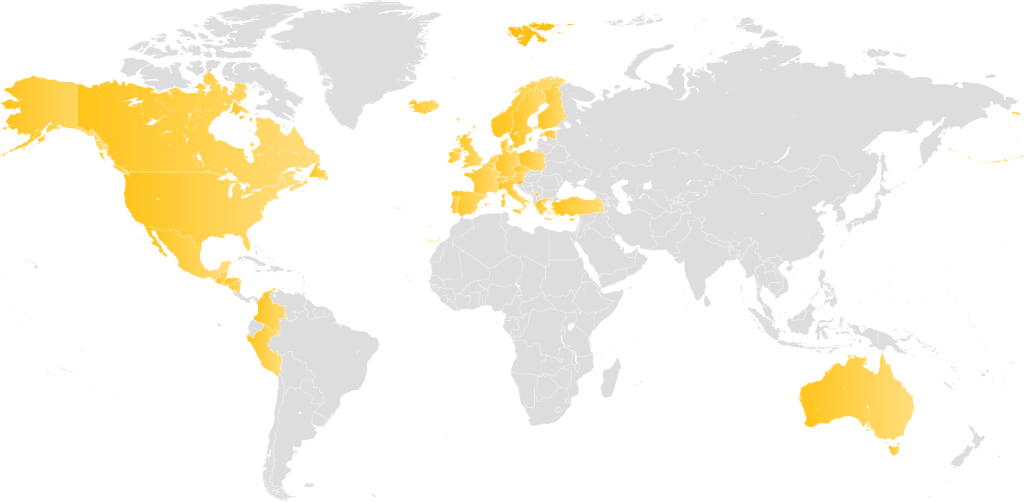
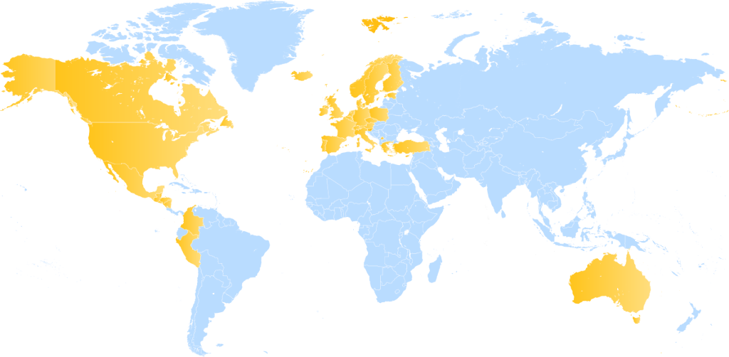
Topnet Live correction services are currently available in Europe, North America, and Oceania. These regions benefit from extensive coverage, allowing users in these areas to take full advantage of the high-precision GNSS correction data provided by Topnet Live. For the most up-to-date coverage information, users are encouraged to check the Topnet Live website for detailed maps and service notifications.
Skybridge is a technology that ensures continuous service by seamlessly switching between correction data sources, such as Realpoint and Starpoint, depending on the best available signal. This guarantees uninterrupted accuracy even in challenging environments.
Technology Operation
Topnet Live technology works by receiving satellite data and applying corrections from a network of ground-based, continuously operating reference stations. At time of connection, the mobile GNSS receiver, or commonly referred to as a rover, position is sent to the Topnet Live server to determine a correction relative to that receiver’s location. This corrected data is then transmitted to the GNSS receiver in real-time, ensuring greater accuracy and reliability.
Each type of correction service offers unique benefits catering to specific needs across various applications. The "Correction via Internet" service is ideal for users requiring high accuracy in well-connected regions, making it perfect for rapid, dynamic tasks such as construction and machine control. The "PPP via L-Band" service, though requiring a longer initialization time, provides global coverage and is invaluable for remote surveying and agricultural applications where internet connectivity may be limited. Lastly, the combined "Correction via Internet or Radio with Satellite Backup" offers a seamless and reliable solution, ensuring continuous and precise operations across both regional and local scales, ideal for diverse environmental conditions in surveying and agriculture.
Topnet Live coverage maps show the geographical areas where correction services are available. These maps are regularly updated and can be accessed on the Topnet Live website to ensure users are aware of service availability in their regions.
Both Realpoint and Starpoint correction services provide centimeter-level accuracy, essential for applications demanding extreme precision. Realpoint delivers RTK (Real-Time Kinematic) corrections, which offer near-instantaneous updates, making it ideal for dynamic activities like autonomous vehicle navigation and machine control in construction. On the other hand, Starpoint employs PPP (Precise Point Positioning) corrections, which, though requiring a longer convergence time, ensures highly accurate positioning over wider areas without needing local base stations. Starpoint's ability to deliver precise data even in remote locations makes it suitable for applications such as offshore surveying and agriculture.
Initialization and convergence refer to the process of achieving full accuracy with GNSS correction services. Initialization is the initial period needed to start receiving correction data, while convergence is the time required for the system to reach maximum accuracy.
The duration of initialization and convergence varies depending on the type of correction service and environmental conditions. Realpoint initialization time is just seconds, while Starpoint Pro initialization can be as low as 3-10 minutes, depending on receiver and antenna type with the latest firmware.
Yes, you can start working with Starpoint before full convergence, but the accuracy will improve over time as the system converges. It's recommended to wait for full convergence for tasks requiring the highest precision.
No, the receiver does not need to remain stationary during the convergence process for Starpoint. However, maintaining a stationary position can help achieve faster and more accurate convergence.
Variable convergence times for Starpoint services are due to factors such as satellite visibility, atmospheric conditions, the receiver and antenna types and dynamic conditions. These factors can influence the time it takes for the system to reach full accuracy.
Topnet Live corrections support multiple GNSS constellations, including GPS, GLONASS, Galileo, and BeiDou. This multi-constellation support enhances reliability and accuracy by leveraging a greater number of satellites.
Topnet Live positions are calculated and stored in the WGS84 coordinate reference frame, ensuring global compatibility and consistency in positioning data.
Regional Realpoint RTK corrections are typically referenced to local coordinate systems for high accuracy in specific regions, while Starpoint Global PPP corrections use the International Terrestrial Reference Frame ITRF2020 at the current epoch. In our case we use ITRF2020 at the current epoch as the most accurate and latest global reference frame for broader applicability and uniformity.
Single base GNSS corrections are distance dependent, meaning that the further you are working away from the base it becomes much less reliable and accurate. Topnet Live correction services offer superior accuracy and reliability compared to single base GNSS correction methods, over wide areas, regions and countries. The network-based approach of Topnet Live provides better error correction and wider coverage, essential for professional applications.
Yes, Topnet Live offers Virtual Reference Station (VRS) technology as part of its suite of correction services. VRS allows for high-precision positioning across extensive areas by simulating a virtual reference station near the user's location. This method enhances accuracy by minimizing atmospheric errors and adapts dynamically to changing environments, providing reliable real-time corrections. VRS is particularly beneficial in applications such as land surveying, construction sites with machine control systems and precision agriculture, where maintaining consistent precision over wide-ranging terrains is crucial.
Virtual Reference Station (VRS) and single baseline methods are both techniques used in GNSS correction services for improving positional accuracy. VRS operates using a network of physical reference stations to create a virtual reference point near the user's location. This allows for real-time kinematic (RTK) corrections that account for regional atmospheric conditions, resulting in highly accurate positioning typically within a few centimeters. In contrast, the single baseline approach relies on a direct connection to a single, physical reference station. While it can provide high accuracy over shorter distances, its effectiveness diminishes with increasing distance from the reference station as it becomes more susceptible to local environmental factors and less reliable in areas with fewer base stations. The network-based VRS method enhances coverage and decreases dependency on proximity to physical stations, offering a more robust solution for diverse operational environments.
Topnet Live provides VRS (Virtual Reference Station) operations with a rover, allowing it to receive high-precision correction data tailored to its specific location. The process begins with the rover sending its approximate position to the Topnet Live network. The system calculates optimal correction parameters using data from a network of reference stations and sends these parameters back to the rover in real time. This enables the rover to apply precise regional corrections, achieving centimeter-level accuracy.
By maintaining an optimized network as the rover moves, VRS with Topnet Live enhances the accuracy and efficiency of operations.
Topnet Live services are highly reliable, with robust, redundant and resilient infrastructure with continuous monitoring to ensure consistent performance. The use of multiple ground reference stations and advanced algorithms enhances the reliability and accuracy of correction data.
Spoofing and signal disruption pose significant threats to the reliability and accuracy of GNSS-based correction services. Spoofing involves emitting counterfeit GNSS signals with the intent to deceive receivers into calculating erroneous positions. This can lead to significant operational issues, particularly in critical applications such as surveying, agriculture, and autonomous systems. Signal disruption, often caused by jamming, blocks legitimate GNSS signals, preventing receivers from obtaining accurate position information. Both threats underscore the importance of resilient infrastructure and advanced algorithms to detect and mitigate interference.
Topnet Live employs a multi-layered approach to protect users from signal spoofing and disruption. The system integrates advanced algorithms designed to detect and mitigate interference from both spoofing attempts and jamming. Additionally, it leverages a network of reference stations that continuously monitor signal integrity, allowing for real-time identification and correction of anomalous data. Through rigorous validation processes, Topnet Live ensures the accuracy and reliability of its correction services, even in the presence of potential threats. Furthermore, the use of encrypted communication channels helps safeguard data integrity during transmission, providing users with an added layer of security against unauthorized access and manipulation. Overall, these protective measures enable Topnet Live to deliver consistent and trustworthy positioning data critical for various applications.
Topnet Live Realpoint correction services are compatible with a wide range of GNSS receivers from various manufacturers. Topnet Live Starpoint correction services are compatible with Topcon HiPer VR, HR receivers and B125, B210 OEM boards. Be sure to check the Topnet Live web portal for up-to-date information and requirements.
The Topnet Live web portal offers various features, including access to coverage maps, service status updates, subscription management, dealer and enterprise management support, real-time logged rovers, connection history with quality indicators, real-time rover support, tools for downloading RINEX data and using coordinate computation services and much more.
Depending on the subscription type, we recommend using the following Network RTK RTCM MSM (Multi-Signal Messages) mountpoints which will work in any network location and provide the latest multi-GNSS correction and signal data support.
Agriculture: AG_NET_MSM4 (Network RTK)
Geo/MC: NET_MSM5 (Network RTK)
Network RTK correction mountpoints are used to simulate a base station at the user location and are generated from both a full set of model Network corrections and the nearest physical station.
Both types of MSM messages above fully support all RTK correction data but are optimized for the intended application. Depending on the users GNSS receiver, antenna and local network capability, the rover may consume and use the full wave of all GNSS signals sent to the rover or may only consume a limited set of the data such as GPS & GLONASS only.
If you wish to only use the nearest base RTK data, then the following recommended mountpoints are also available.
Agriculture: AG_RTK_MSM4 (Nearest Base RTK)
Geo/MC: RTK_MSM5 (Nearest Base RTK)
Other mountpoints are available for specific local country coordinate transformations or for much older receivers with firmware that may not support the latest RTCM MSM data messages. (please refer to your local network representative for further information)
Additional Features
To download RINEX data, log in to the Topnet Live web portal, select the desired date and reference station, and download the data files directly to your computer. Detailed instructions are available in the portal's help section.
The coordinate computation service can be accessed through the Topnet Live web portal. Input your raw GNSS data, select the desired processing settings, and submit your request. The system will process the data and provide computed coordinates.
To check your rover connections, log in to the Topnet Live web portal and access the device management section. Here, you can view the status of connected rovers, monitor signal quality, and troubleshoot any connection issues.
Subscriptions
1. Realpoint subscriptions:
- Personal subscriptions (1 user over a standard duration):
○ 1 month 3 months 6 months 12 months
○ 50 hours, 250 hours
- Pooled hours for multiple users/devices:
○ 20 hours, 100 hours, 250 hours, 2000 hours, 10000 hours
2. Starpoint Pro / Skybridge Pro subscriptions:
- 1 month
- 3 months
- 12 months
3. Rinex subscriptions
4. Educational subscriptions
Topnet Live correction services are activated using the Topnet Live Manager web portal. Users need to log in to the portal, select the desired subscription, and follow the instructions provided to activate the service.
To retrieve your receiver PAC ID, use the Topcon Receiver Utility (TRU). Connect in Receiver Managing Mode, then press the Receiver Information icon. This action generates the Receiver Info report, where the PAC ID is shown in the 4th line of the GNSS Board section.
Technically, automatic renewal is possible, but it is a business decision and may vary based on specific agreements or policies.
Customers will receive three email notifications:
1 month prior to the expiration
1 week prior to the expiration
As soon as the subscription expires
Get in touch
Thank you! We will be in touch.