Seeing is Believing")
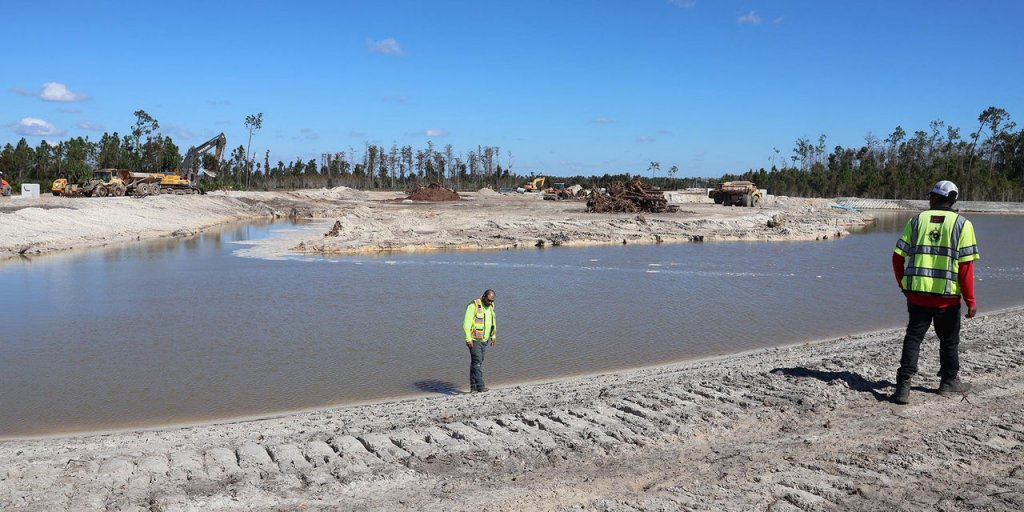
Even given the myriad benefits GPS-based machine control can bring to a jobsite, perhaps its most basic value lies in its ability to, quite simply, make things happen. That impact can include quickly making grade appear where none was before, easily cutting the most accurate of utility ditches, even excavating or sloping a sub-surface retention pond. For South Florida Excavating (SFE), that latter advantage has proven the proverbial “game changer,” turning a facet of the job that was inefficient, time-consuming, and often risky, into simply another part of the smooth, machine control workflow. Running a modest — but effective — indicate-only solution on a pair of excavators has allowed them to grade beneath the surface with confidence while eliminating continual grade checking and rework. Simply put, it’s made some great things happen.
- image 1
- image 2
- image 3
- image 4
Out With the Old
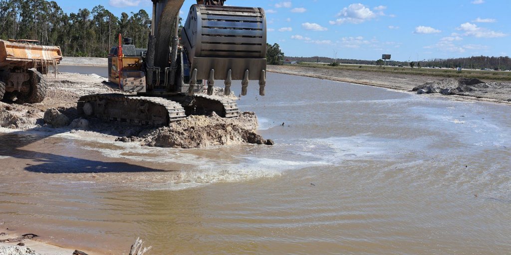
Fast forward to 2022 and a growing sense that the same benefits they were seeing from their existing automated fleet could be realized in the creation of ponds or lakes, a big part of their workload. According to Donahue, one of the more vexing jobs on any contractor’s radar — particularly in areas with a high water table — is the ability to quickly and accurately excavate for ponds and lakes. Traditional approaches such as painting marks on the side of the excavator boom, having a man in a boat with a grade rod or, in some cases, having a rod man stand in an excavator bucket to verify the pond bottom, have long proven risky and inefficient.
“The goal, of course, is an accurate verification of the pond bottom, and that becomes increasingly difficult as the depths increase,” he said. “I knew only too well about the old-school approaches; that’s what I did coming up in the business. So, when we learned that we could use the GPS solution to essentially ‘see’ the bottoms of the structures we’re building, we knew it’d be a good fit. We were not wrong.”
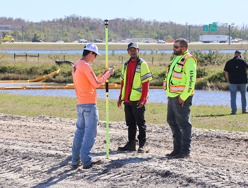
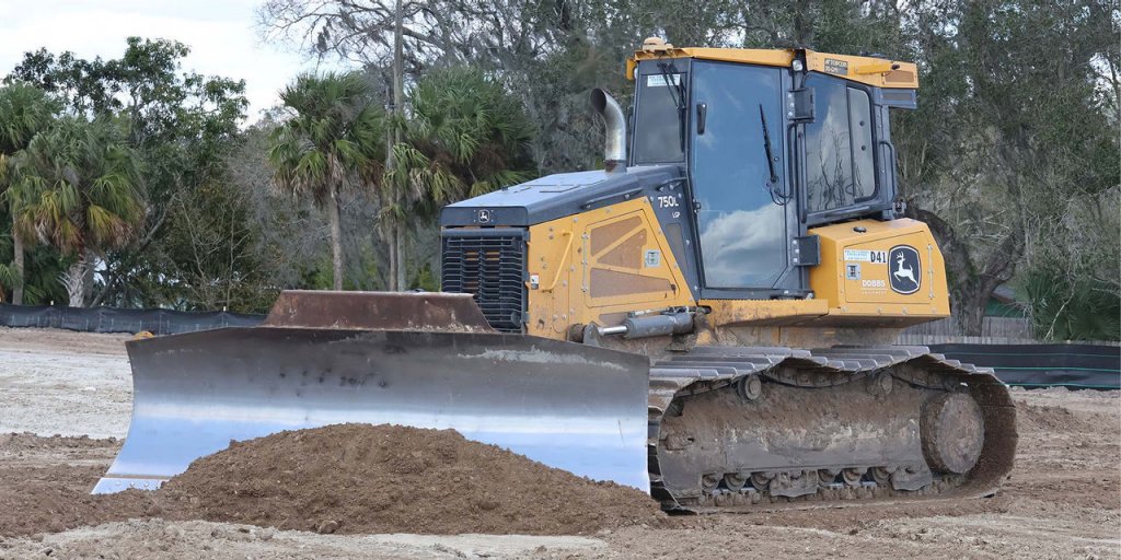
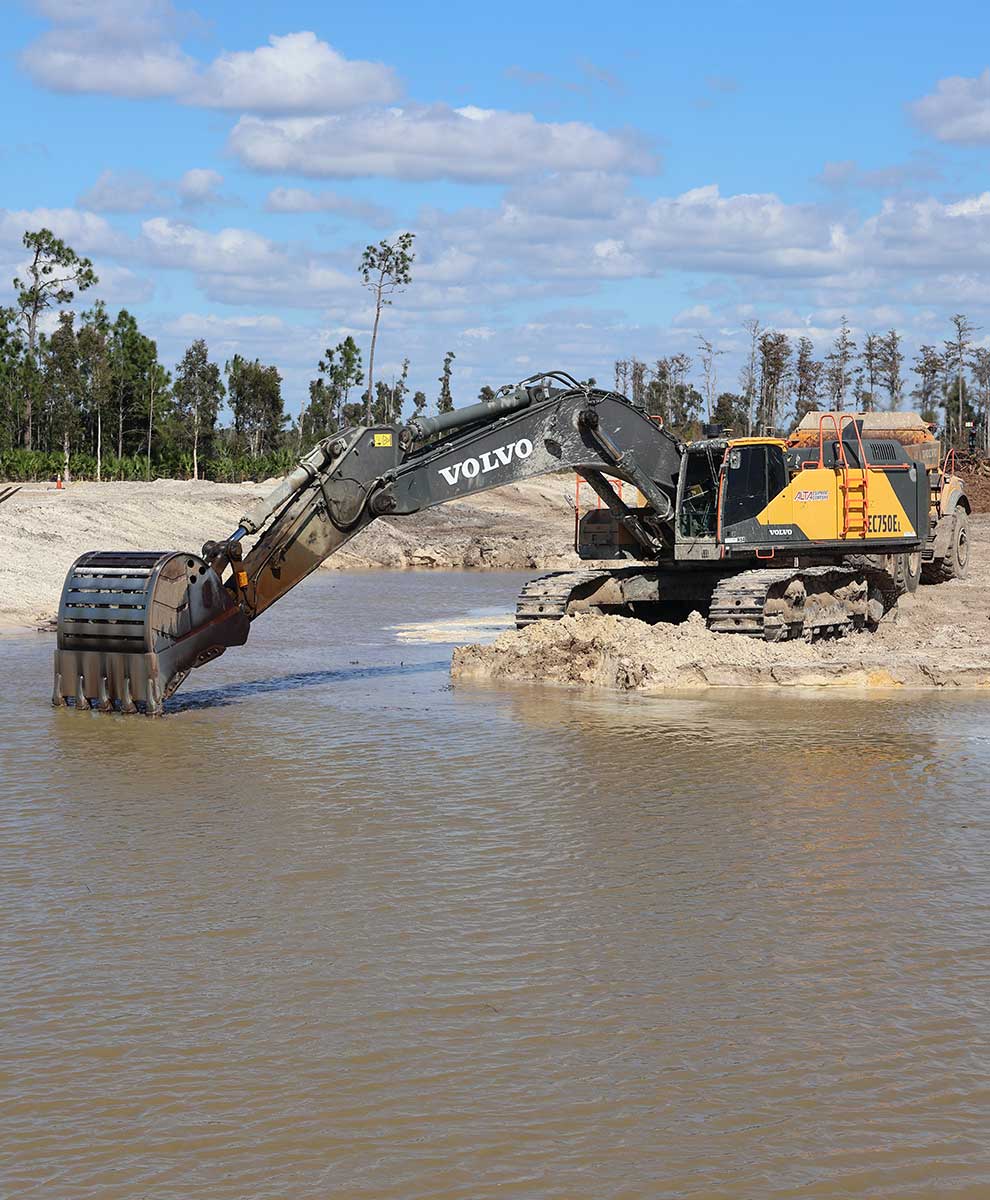
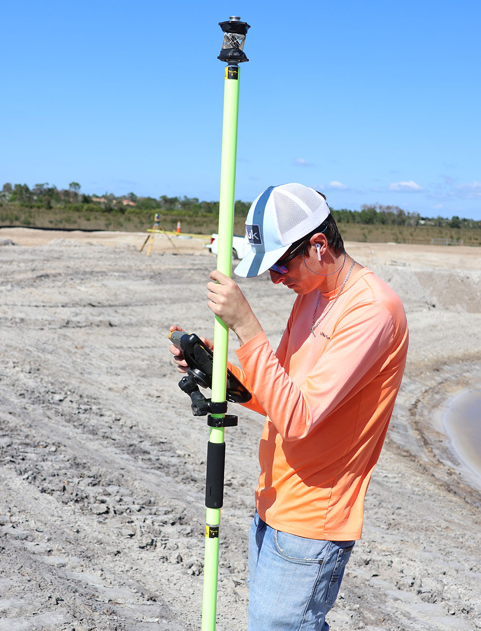
Working again with the team at Lengemann, Corp., SFE outfitted a pair of their excavators, first a John Deere 870 and shortly afterward, a Volvo 750, with a Topcon indicate-only system. As was the case with the grading equipment, the effect was head-turning. “Even though the solution we chose did not provide full control as it does on the dozers and graders, we understood that going in. But we were still blown away by the fact that our operator could look at the screen in the cab and know exactly where he was — and where he needed to be. That was huge for us.”
“With a GPS system on ten machines, we’ve been committed to automation on our dozers and motor graders for more than a dozen years now.”
— Shannon Donahue, SFE supervisor
Fond of the Pond
Because of the surroundings in which they work, the impact the new solution had on SFE was perhaps more profound than it would be by most. The region’s high water table affects most every aspect of a project, making pond construction almost an inevitability. According to Cory De Vries, also a supervisor and SFE’s GPS specialist, that plays nicely into the advantage the excavator system provides.
“For a number of reasons, ponds are in almost every design plan we encounter,” he said. “The obvious need for a retention pond, to catch runoff — as well as the design aspect — are certainly a huge part of it. But there are other reasons as well, not the least of which is the cost of fill which has literally doubled in this area of late.”
Because of those skyrocketing costs, developers today, rather than importing fill, are opting to get all the material they need by excavating a lake or pond. “As a result, we find ourselves continually tapping the benefits the Topcon system brings to the job.”
Indications are Good
The system to which De Vries refers, combines Topcon GNSS global positioning technology and machine sensors with a GX touchscreen color display to provide SFE’s operators with an at-a-glance solution for excavation accuracy and efficiency. The solution is also easily upgradeable for fully automatic operation — which SFE is currently considering — and is configured for easy integration into Sitelink3D, Topcon’s real-time job site management solution.
“We’ve already purchased Sitelink3D and though we haven’t utilized it yet, we’re excited to put it to use,” said Donahue. “As a company, we cover a lot of area throughout this region and have anywhere from eight to 20 jobs going on at any given time. The logistics of managing all the machinery, the files, the model revisions, etc., can be a challenge. I can see Sitelink3D saving us a lot of time and effort.
“We’ve already purchased Sitelink3D and though we haven’t utilized it yet, we’re excited to put it to use.”
— Shannon Donahue, SFE supervisor
Easy and Accessible
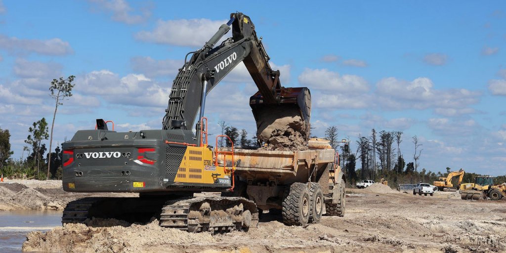
The SFE fleet mentioned above, while heavily slanted toward Volvo and Deere, also includes Cat machines and other brands. According to Trey McKinney, Lengemann’s West Coast sales representative, the mix of machines does not present any issues for machine control adaptability.
“The Topcon solutions are an easy install and work seamlessly across brands,” he said. “Things really became easy once everything went CAN (controller area network). As long as it’s a fairly new machine, chances are Topcon has a kit developed for the CAN code to make it work. We’ve installed scores of these systems and haven’t encountered any hurdles at all.”
One of SFE’s current projects, the Three Oaks Parkway Extension in Bonita Springs, Fla., is typical of the pond-heavy situation described above. As the name implies, Three Oaks is an extension of the major throughfare serving an area rich in retail development. Though only 2.2 miles in length, the project calls for the creation of three ponds, each five acres in size. While many companies dewater an area before digging a pond, SFE’s preference is to do them without the dewatering process, making the GPS solution all the more valuable.
“We are currently about 90% complete on the first pond and dealing with a lot of rock on the second one,” said Donohue. “But now, rather than going through the manual grade check process I mentioned earlier to determine the elevation at which the operator is hitting rock, it’s a simple matter of calling him and asking him to verify it on screen. Dealing with issues like that, coupled with eliminating the need for re-work, etc., have made a world of difference for us.”