On a recent project to replace the municipal boat launch in Seward, Alaska, Hamilton Construction was presented with a challenge: create an accurate 13% slope to support the new structure’s sleeper timbers and concrete planks, but do so in tidal conditions, making visual verification of their progress difficult, if not impossible. Realizing that “business as usual” was no longer in play, the company turned to a GNSS solution for the excavator constructing the slope. With that system in place, the operator was able to see exactly what he was creating on the floor of Resurrection Bay, confirm the accuracies needed for the project, and do so in conditions that would have rendered alternative methods largely ineffective. The net result of their efforts includes a new boat launch for Seward — and an effective way to address challenges for Hamilton moving forward.
Upgrade in Order
Seagoing vessels of all types — everything from standard boats to fishing trawlers to personal yachts to mammoth cruise ships — are a regular component of life in Seward. While commercial fishing is central to the area’s economy, recreational boating and fishing are popular pastimes as well and the existing launch, built after the 1964 earthquake, was deemed sorely outdated and beyond feasible repair. With that, and an overall modernization in mind, the City of Seward recently undertook an effort to demolish the existing structure and replace it with an upgraded design to allow launching even in minus-tide conditions and improve ADA-compliancy. For Hamilton Construction which secured the bid for the $4 million upgrade, that meant first finding a way to create an accurate slope.
“This is a major upgrade for this facility,” said Randy Hammer, Hamilton Construction’s project manager. “In addition to the sloped launch itself, everything is getting a revamp including the more than 20 large boarding floats which will now be more ADA-compliant. But, before we could get to installation of any kind, we had to first ensure that the ramp’s 13% slope design could be created.”
With demolition of the old launch complete, Hamilton’s crew began the reconstruction, working off of a barge with an indented area at the forefront of the vessel into which the excavator was positioned.
Getting Their Fill
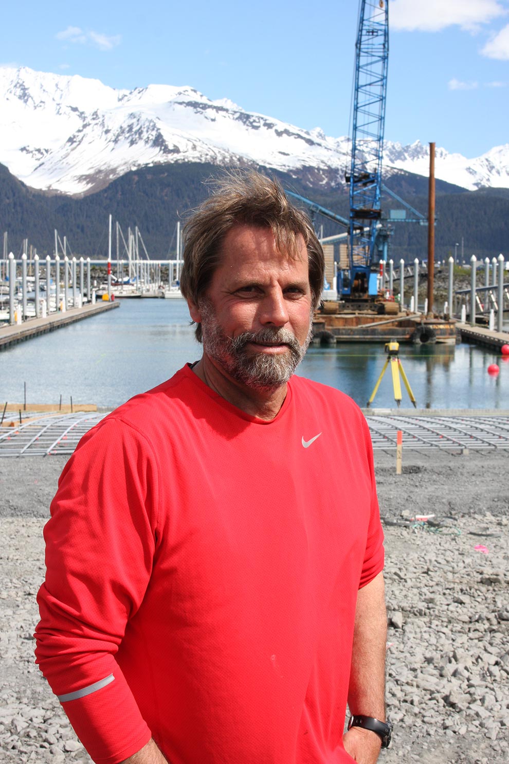
As might be expected, the bulk of the work Hamilton did to create the base for the sloping element of the launch involved adding material rather than removing it. According to Shane Thoe, the company’s equipment operator, roughly 600 cubic yards of 6”-minus material was brought in to create the feature which measured 83’ wide and extended 190’ into the water.
“The most significant change in the design of the new launch is the length it extends into the water,” he said. “In the past, people were limited by the tidal conditions to decide when they could launch; that won’t be the case anymore. However, we still needed to find the best way to get all that aggregate down and sloping at the appropriate angle. For that, our owner turned to Alaska GPS, the area Topcon dealer.”
Working through Mike Williams, co-owner of Alaska GPS, Hamilton opted for a Topcon X63 system for their Hitachi Zaxis 120 excavator. They did so, despite the fact that they normally used a different manufacturer’s base station and other GPS gear.
“Hamilton’s regular GNSS solution relies upon a spread-spectrum radio, and even though the Topcon X-63 system relies upon UHF for its signal, we were able to make the two systems talk to each other,” said Williams. “Specialty requests like that are not uncommon for us up here. And Hamilton is pleased with the way it’s worked out, which is what it’s all about for us.”
A Look Below
The primary advantage of the GNSS system Hamilton chose was in its ability to allow the operator to “see” what he was laying down. Using 360° tilt sensors located on the boom of the Hitachi machine to track the position of the bucket, Hamilton’s Shane Thoe was able to know what he had put down, and verify that the slope was correct, monitoring progress on an in-cab screen.
“In a sense, I was actually serving as the grade checker on this job,” he said. “Though our diver did have to occasionally go down to verify some things, it was nowhere near what would have been the case before. And the accuracies we were getting with the system were impressive; this was a great solution to a challenging problem.”
In addition to creation of the launch area itself, Hamilton’s team had to surround the entire structure with a wall of rip-rap which also had to maintain that 13% slope. According to Randy Hammer, the GPS proved invaluable in that function as well.
“Because Shane could just place the teeth of the bucket down and know, with impressive accuracy, the location and elevation of the wall he was creating — even when the slope took it under water — that part of the job was streamlined,” he said. “It’s worth noting that, because all the work was being done off a barge, things were made even more challenging. Vessels like that have a tendency to ride up and down as well as side to side, so the excavator has to move slower than it would on ground. But Shane is probably the best operator I’ve ever worked with in my career, and his skills, teamed up with the GPS made things come together nicely.”
Mothers of Invention
With the base rock in place, a layer of sleeper timbers was laid down, followed by ___ planks, each measuring 2’ X 20’ X 1’ thick. Because each plank weighed about 8,000 lbs., getting them down and set in place was far from easy. Hammer said that one of their crew, Scott “Scooby” Campbell, who also serves as a mechanic, laborer, operator and diver, fabricated the solution for that.
“Working off a fork attachment for a front-end loader, Scooby devised this on his own, and welded it up in one afternoon,” he said. “We call it ‘The Flying Forks’ and it is suspended from a crane, holds a plank in place for positioning and, when it’s in the right position lets it go for placement. It has worked incredibly well for us.”
Unlikely Alternatives
Though alternative approaches do exist for a project like the Seward South Ramp Launch Renovation, the fact that they were looked at and bypassed, speaks volumes for the growing influence of GNSS technology.
“Without GPS on this job, we would probably have had to work the tides,” said Hammer. “That would have meant working in the winter when they are really low, which would have also meant doing all the dirt work in January. As anyone who’s been here knows, that means dealing with frozen ground, adverse weather, winter storms, and so on. Construction costs would have probably been quadruple what they are, and we got it done in a fraction of the time that would have taken. Pardon the pun, but, without it we would have been ‘dead in the water.’”
A ribbon-cutting ceremony for the new boat launch was held on June 26, 2019.