_web_hero.jpg)
There are people who are gifted with an ability to see opportunity, seize it and turn it into something positive, even life-changing. The brain trust behind the Google search engine saw an opportunity to provide users with a means to scour the internet and instantly provide links to the info they need. Facebook would not be the entity it is today had its founders not recognized people’s need to connect, filled that need, and monetized the process. While Tim Arnold is certainly not in the same stratosphere with those two examples, he too, saw a need within the Western New York construction community for someone to take the helm of the GPS and survey-related facets of their jobs. Moving to fill that gap, he established Terratek GPS Modeling. Today, his company has grown, along with the range of services offered, and his standing with his clients. Carpe diem? Arnold didn’t just seize the day, he solidified his future.
“I bought the LN because it was the most affordable unit available to do the tasks I anticipated doing. Little did I know what a great tool it would turn out to be."
Timothy Arnold, President, Terratek GPS Modeling
Model Employee
Armed with a degree in civil engineering, Tim Arnold’s first foray into the business world was in construction management — which he immediately realized was not his calling. He preferred instead to be more involved in the building side of things.
“In about 2014, I became good friends with Scott Miller who owned Scott Lawn Yard in Buffalo, one of the site contractors we had as a client,” he said. “Scott saw that I was ambitious and, even though he knew I wanted to start my own business, offered me a job doing their digital models. I worked for him for a couple of years which really helped me learn things from the contractor’s standpoint, before starting Terratek GPS in 2017.”
His situation could not have been any more ideal for a startup company. Though the larger contractors in the WNY area generally had their own in-house GPS support — and still do — small to mid-size companies were lacking in that area.
“I started with a focus on building models for site work and concrete contractors, but quickly realized that, to succeed, I also needed to offer additional site support — construction staking, as-builts, etc. However, after I added earthwork takeoffs, as-built drawing prep, basically everything a contractor with GPS capability needed, I saw I was the only company in the area offering such support. My business was off and running.”
Quality in Quantity
Fast-forward to the present and Terratek has added staff, serves clients in virtually every part of New York state and surrounding areas, and has beefed up their capabilities menu even more. In addition to the strengths mentioned above, the company also offers CAD training, trains client personnel on Topcon equipment and, of late, has been focusing a good deal on quantity analysis. At the heart of that last push are two factors: many projects — and all DOT jobs — base payment on quantities, and a deeper dive into the engineer’s quantity estimates often uncover errors that can impact the bottom line.
“I have one client in particular that I work closely with on quantity analysis,” he said. “For them, we basically measure everything we do and report it all by item number. If there is an overage, we bill it and provide my drawings and the model as the necessary backup. That’s a valuable resource to bring to a client.”
Just how valuable, he found, can be staggering. On one job, the owner had a note in the drawing stating they would pay more if construction was done a certain way — digging for curb before digging for underdrain, for example. So, after swapping the engineer’s estimate from one item to another, correcting errors caused during survey, exposing some over digging, etc., Arnold’s client presented the owners with some revised numbers.
“After all the changes were implemented, the savings totaled around $400,000,” he said. “Obviously, given that, my client sees a lot of value in quantity analysis. Granted, the number won’t be that large on most jobs, but there are substantial savings out there if a company wants to look for them. And I can provide the tools to do just that.”
Navigation Station
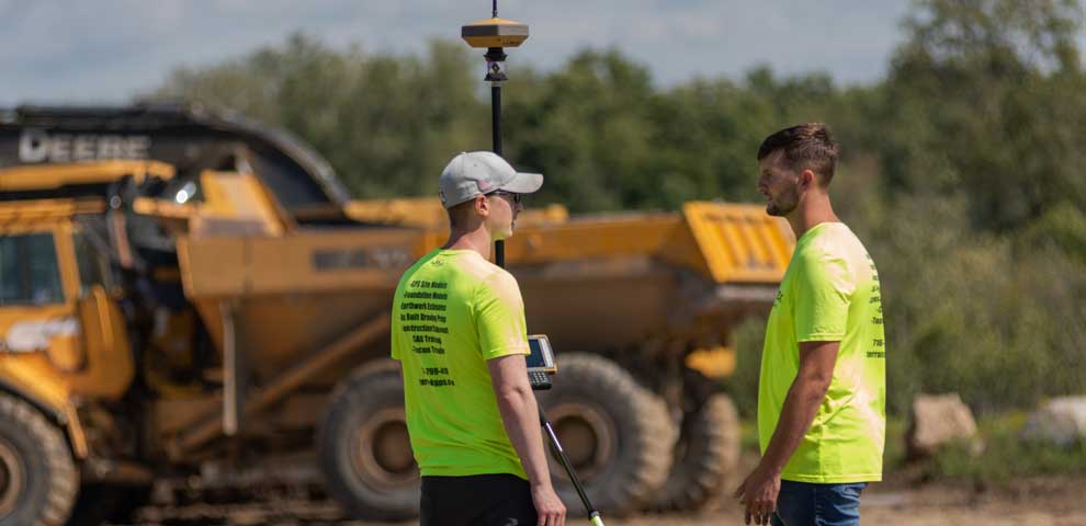
In addition to his survey skills, the tools to which Arnold refers, include an all-Topcon lineup including a GT-500 robotic total station, HiPer VR receiver, FC-5000 field computer and LN-100 layout navigator. His decision to use Topcon solutions stems from the fact that, when he started his business, so many companies in the Buffalo area — who he saw as potential clients — were also Topcon users. He was also won over by the company’s layout navigator (LN), the first instrument he purchased for his then-fledgling company.
“I bought the LN because it was the most affordable unit available to do the tasks I anticipated doing," he said. “Little did I know what a great tool it would turn out to be. It can do anything in layout, and, because it is fully enclosed, self-leveling and has no eyepiece to look through, it’s perfect for concrete contractors and the like. Just set it up and ‘see you later.’”
Supplanted since by the more powerful LN-150, the layout navigator streamlines the digital layout and construction verification workflows. Designed for ease of use, the tool’s inherent strengths increase productivity, accuracy, and bottom-line savings. “The LN was my go-to layout tool when I started and it still is today, four years later,” said Arnold.
"With the hybrid solution I walked over and, with literally the press of a button, a prism icon on my controller changed to look like a rover, indicating that I was now using GPS. It’s that easy to flip back and forth between optical and GPS.”
Timothy Arnold, President, Terratek GPS Modeling
Playing Both Sides
As is the case with most survey personnel, once he steps on site, Arnold is constantly barraged with requests which take him away from the work at hand. While it is nice to feel wanted, he said meeting those requests could, in the past, seriously impact his own productivity. That changed in 2019.
“I can’t remember a day when I have not been sidetracked by someone on site,” he said. “Once the client gets used to you being there it is: ‘what do you think about this?’ ‘Can you just grab this one point for me?’ and a job I anticipated would only take four hours, took much longer. But a while back, when I was renewing the license for my MAGNET software, the salesperson for Admar Positioning, the area Topcon dealer asked why I wasn’t running the hybrid solution for my total station. After he explained what it could do, the benefits it could provide and the minimal cost to me, I was asking the same thing."
The Hybrid Positioning function to which Arnold refers, is a software-based solution that allows his GT-500 total station to provide capabilities for both GNSS positioning and optical robotic measurement on one rover pole. Arnold said the minute he got it those onsite distractions no longer became an issue.
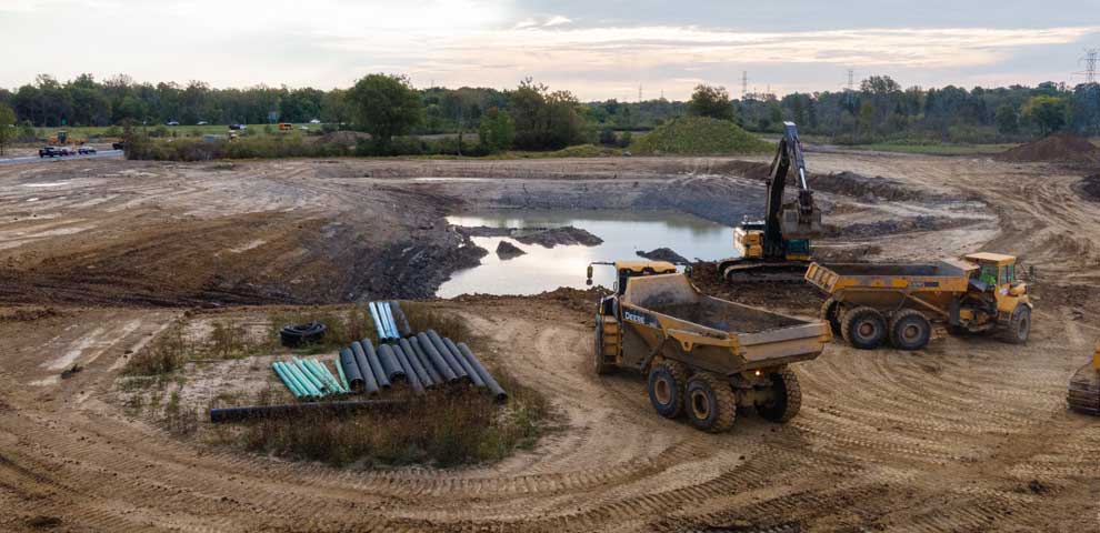
“We are currently working a residential development site in Hamburg, south of Buffalo, that features a huge retention pond,” he said. “One day, I was busy laying out for curb with the robotic unit when I was asked to measure for the bottom of the pond. In the past, switching gears like that would have been a time-consuming effort. But with the hybrid solution I walked over and, with literally the press of a button, a prism icon on my controller changed to look like a rover, indicating that I was now using GPS. It’s that easy to flip back and forth between optical and GPS.”
He added that the hybrid solution is also great for dealing with loss of signal caused by foliage canopies or other obstructions. He cited a recent project doing layout for a school with a small courtyard in the center. “It was a small enough area that, if you did a 45° angle, you were hitting top of building,” he said. “Anticipating trouble catching and keeping a GPS signal, I brought the hybrid solution to that job. Doing so, I would say, probably shaved 10-15 hours off the time we were out there.”
Team Effort
Though it would seem that Terratek has excelled on its own, Arnold is quick to correct that misconception, pointing to both Admar Positioning and Topcon as major contributors to his success.
“Admar is fantastic for several reasons,” he said. “One, they answer their phones — a simple act that is hard to come by these days. My contact there, Chad Arva, will always take a call or get back to me within ten minutes. Two, they have experienced people like Mike Conley. Mike has been around since I started and I have never stumped him with a problem . . . ever. Three, if something goes down, they bring out a loaner within 24 hours — no questions asked. I have two clients who use equipment from a different manufacturer, meaning I have to deal with their dealer. So, I’m able to compare and it is not the same experience at all.”
He added that he cannot overstate how easy it was to build a business, largely because the products Topcon makes available seem geared for an entrepreneurial, engineering-background type like him.
“Everything from their level of support to reasonable pricing to the inherent ease of use made it relatively easy for me to get started and quickly dominate in this area. Without all that, the future wouldn’t look anywhere near as bright for us as it does now. I might have made the most of the opportunities I got, but a lot of people contributed to making those opportunities even possible — and for that I’m grateful.”