Process, combine, and analyze point cloud data
Stitch together mobile and static scan data into one immersive 3D environment. Collage Office combines, visualizes, and publishes raw point cloud data from lidar scanners, mobile mapping, BIM, CAD, GIS, or other sources.
Working with your existing CAD and modeling workflows is simple
Once your consolidated point cloud or mesh is built, easily export the file to industry-standard modeling or CAD software or directly publish online with Collage Web.
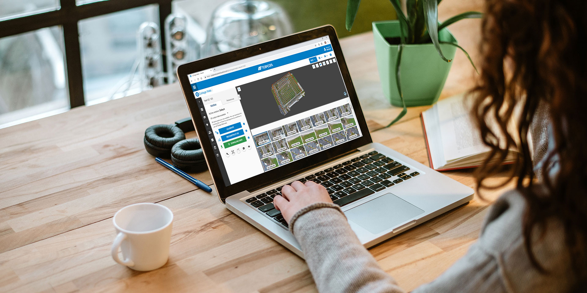
Collage Web and Cloud Connector: Revolutionizing 3D Collaboration and Workflows
Collage Web revolutionizes team collaboration by enabling seamless sharing of 3D models and datasets through the cloud. With features like panorama, 3D, and map views, along with split-screen functionality, teams can easily compare and annotate models in real-time.
Enhancing this ecosystem is the Collage Cloud Connector, a lightweight Windows app that syncs project data from Collage Web to local machines, ensuring smooth integration with Autodesk and ClearEdge3D software. This tool not only simplifies downloading and version control but also supports hybrid workflows, allowing users to work efficiently with both cloud and local data. When paired with ClearEdge3D’s Tools for Revit, the Connector optimizes scan-to-BIM and QA/QC workflows, making it a game-changer for professionals handling point clouds, panoramic imagery, and as-built data.
Use cases
Surveying and construction jobs
Volume calculations
Surface modeling
Terrain analysis
Historical preservation projects
Environmental studies
Infrastructure management
Orthophoto creation
Related offerings


Get in touch
Thank you! We will be in touch.