When it comes to airport paving projects, accuracy in grade and slope is the great equalizer. FAA specifications dictate the tolerances to which runways and taxiways must conform and those rules govern projects both large and small. So when Crestline Construction won the bid to handle the rehab and replacement of Taxiway A at a regional airport in The Dalles, Oregon, it knew that the facility’s relatively small size was irrelevant. Making spec would present the same challenges they would face if they were working at Portland’s PDX airport or Sea-Tac International. To meet those demands, the paving contractor opted for the same technology solutions changing the paving narrative at larger facilities worldwide. Despite the project’s unending series of radius paves, an initial unfamiliarity with the technology, and a curveball from Mother Nature, the customer was very pleased with the finished product, and, based on the solution’s performance, Crestline has already landed a follow-up airport job several exits westward on I-84.
"When I started to put a paving plan together with survey elevations for this job, I knew just what we were facing: a project that was heavy on curves and radiuses."
John Arambul, Asphalt manager for Kerr Contractors
Long Time Coming
Built as part of the post-Depression recovery, the Columbia Gorge Regional Airport recently underwent a $5.5 million runway renovation to remove a surface irregularity and improve some line-of-sight safety issues. According to John Arambul, asphalt manager for sister company Kerr Contractors, an additional part of that project — which itself carries a price tag of an $4.5 million — called for the construction of a taxiway parallel to the newly-rebuilt runway.
“This is a project that was long overdue,” he said. “Though work on the runway has taken place periodically over the years, including the most recent resurfacing, I don’t believe any work has ever been done on the taxiways. And the taxiway was originally constructed at a time when elevations were not as stringently enforced as they are today, so part of the challenge was tying in the taxiway to the new runway which meant essentially removing all four existing exits.”
Work on Taxiway A began in late April of this year and took approximately 60 days, with an unofficial airport “opening” on July 1.
Knowledge is Power
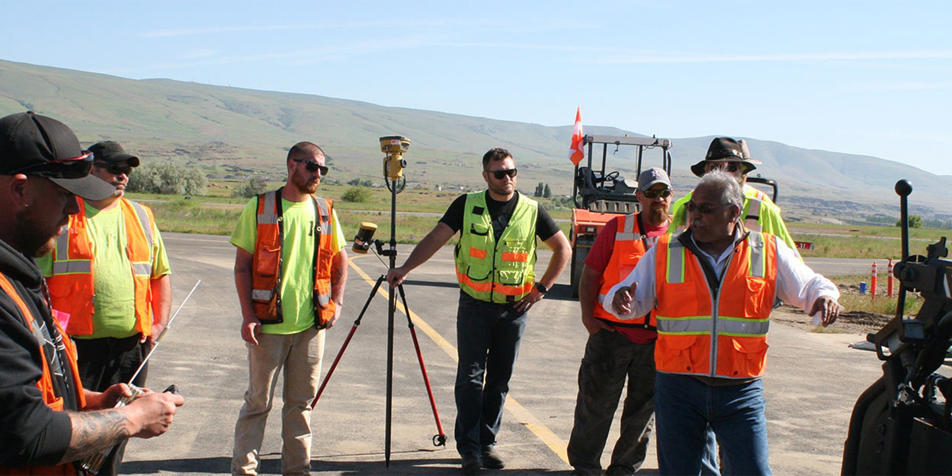
While the CGRA project marks Crestline’s first real foray into asphalt paving for an airport job, Arambul brings a wealth of experience with him from his work with Kerr Contractors on the construction side of the equation. That knowledge would prove to be key in helping deal with the taxiway paving layout.
“When I started to put a paving plan together with survey elevations for this job, I knew just what we were facing: a project that was heavy on curves and radiuses. Up to that point, Crestline had only paved using stringline, so setting line for all those curves would have been far too labor-intensive for this job. It was obvious we needed to take Crestline’s paving to the next level.”
That level was attained though an initial meeting with Richard Hill, paving/construction sales specialist for the PPI Group, Topcon Positioning Systems’ Oregon/Washington dealer. “I met with Richard, explained our situation and the specs we had to meet, and the conversation quickly turned to Topcon Millimeter GPS for our paver,” said Arambul. “I’m not going to say it was an easy sell but eventually we had buy-in from above and we were heading out to The Dalles with a plan and the means to bring it all together.”
"We were able to achieve that accuracy using a Cat motor grader running Topcon 3D-MC² machine control. That is actually tighter than what I’m told 3D-MC² is designed to do — we were impressed with what it gave us."
Alan Easling, Crestline’s project manager
Infrastructure Demands, Technology Responds
Arambul’s situation, and his approach to resolving it, are the perfect illustration of what Topcon has dubbed The Intersection of Infrastructure and Technology. That is the point, they feel, at which industry professionals have the necessary solutions at their disposal — in this case, Millimeter GPS — to meet the demands of today’s projects. Finding themselves at that metaphorical intersection, Arambul and Crestline were immediate beneficiaries of its intent.
“We’ve been paving for a lot of years with stringline and hitting numbers, hitting elevations, but owners on most of today’s jobs are demanding a lot more precision,” he said. “At CGRA, once we started paving with the millimeter equipment and the owners saw the first lifts go down, they were blown away by how accurate we were. We were coming in within .01 to .02 of finished elevation — that won them over.”
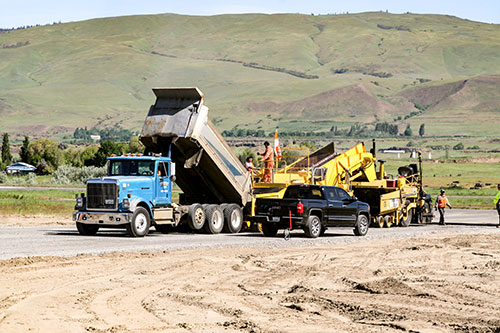
Work on the taxiway included sections that needed to be completely reconstructed, and others that were just milled and overlaid. Dealing with tight specifications started well before asphalt paving, according to Alan Easling, Crestline’s project manager.
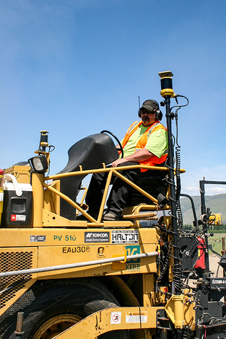
“When dealing with FAA specs, each consecutive layer of base has a tight tolerance, not just the top layer,” he said. “Even the native base, which consisted of one-foot of sand placed in 6-inch lifts, has a ±.05 tolerance. Once we achieved that, we put in 8 inches of 1 ¼” aggregate in two 4-inch lifts. There was 100% compaction between lifts and tolerances had to be within .04 of finished elevation. We were able to achieve that accuracy using a Cat motor grader running Topcon 3D-MC² machine control. That is actually tighter than what I’m told 3D-MC² is designed to do — we were impressed with what it gave us.”
In the Zone
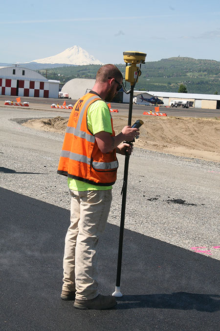
Topcon Millimeter GPS combines field-proven GNSS positioning technology with high accuracy Millimeter GPS instruments and sensors. A pair of receivers, each with an integrated GNSS antenna, are mounted to the left and right side of the paver where they continually decode signals from laser transmitters — broadcasting a Lazer Zone signal 33 ft. in height — positioned along the paving route. Teaming up that approach with a GNSS receiver containing RTK corrected GNSS tracking technology, provides the millimeter grade accuracy needed for the job. Any mid-pave changes or modifications can be easily handled via a mounted control box which provides Crestline’s operators with an interface to the system.
“This was the perfect job for this technology,” said Arambul. “There literally wasn’t a straight line in the work area; to run stringline out there would have added at least a couple days’ work to the project. More importantly, however, we would never have gotten the accuracies we did doing things the traditional way.”