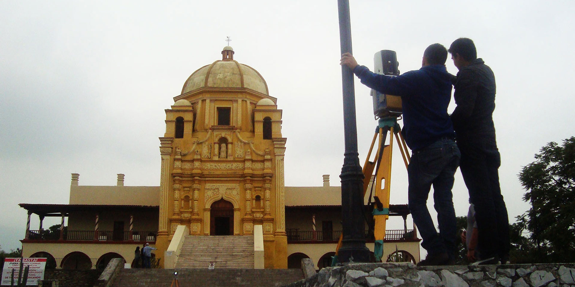
Over five days, the team scanned all four sides of the building, shooting nearly 14 million points. Using a Sokkia GRX1 GNSS receiver, the team set 15 control points and linked them to the vertical datum established by the state so that all of the data will tie into the same elevation for historical purposes. The points also were linked into a four-sided polygon before the instrument was tied to a backsight point, the control points were entered, and the scanning process began.
The team was able to scan at a distance of 450 meters. The museum’s high elevation overlooking Monterrey—and accompanying high winds—challenged the scanning team. The scanner had to be moved from time to time, leading to a fair amount of leveling and recalibrating throughout the process. Still, Martínez said that attempting to survey the museum with a total station was not an option.
Every day, the team went back to the office and downloaded the data from the scanner to a Topcon ScanMaster software file. The data exchange used an SD card that was pulled out of the scanner and inserted into a computer. Any points that were not needed for the point cloud were manually deleted. The points from a given day’s work were overlaid onto the previous day’s scan and if they did not align, the area was rescanned. The department planned to develop a virtual 3D model with the exact dimensions of the building and architectural detailing of both its interior and exterior.
Preserving maintenance archives
Martínez pointed out that archiving 3D models of historic structures in Mexico will allow the owners to preserve the integrity of the structures, even when maintenance is needed. His department is driving acceptance of laser scanning in Mexico, having presented a paper titled “LIDAR Land Surveying Projects” at the International Civil Engineering Congress in Monterrey in November 2012 and developed a video showing the scanner in action. “The more people accept it, the more work we can get with this kind of technology,” he said.
Don Talend, West Dundee, Illinois, USA, is a content producer specializing in covering civil engineering, construction and geospatial topics.