Antarctica has always fascinated me; the extreme cold, the beautiful ice, magnificent mountains, stories of amazing exploration, but most of all – the extreme space and freedom. So, being invited to use the latest Topcon geospatial technology in an area of a blue ice glacier, with a view to establishing a runway for future operations, was an exciting prospect for both me and Topcon. It was a step into the unknown, providing an opportunity to test our products first-hand in a unique environment.
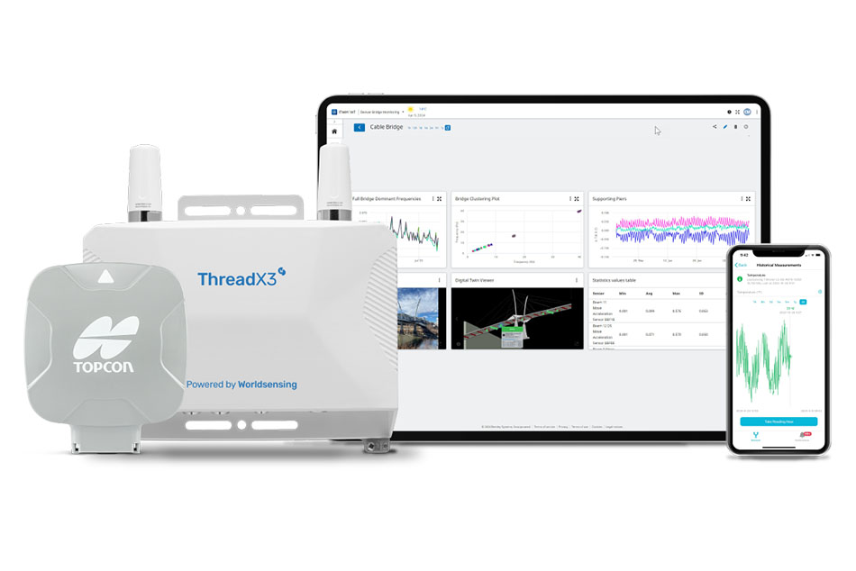
In this job, simply knowing the products is not enough. You need to understand how each intricately works as part of a full workflow and the terrains they can best be utilised. As part of my preparation, I set about deciding on the best surveying equipment to take with me. Given there are little to no obstructions in the sky in Antarctica, GNSS RTK was the obvious choice and the Topcon HiPER HR’S proved to be the most appropriate due to working well in extreme climates and delivering accurate results quickly.
On arrival in Antarctica, we spent the first part of the expedition at Union Glacier Camp, preparing and checking out the equipment. The camp is established on a moving glacier surrounded by mountains and the weather changes quickly which I realised early on dictated our timetable for departure to the remote site.
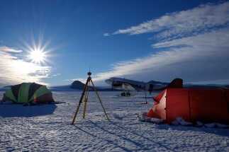
The second part of the expedition saw us fly out to an even more remote part of Antarctica where we anticipated the runway being placed. The rarely visited area is part of the Transantarctic’s Mountains, one of the longest mountain ranges on Earth.
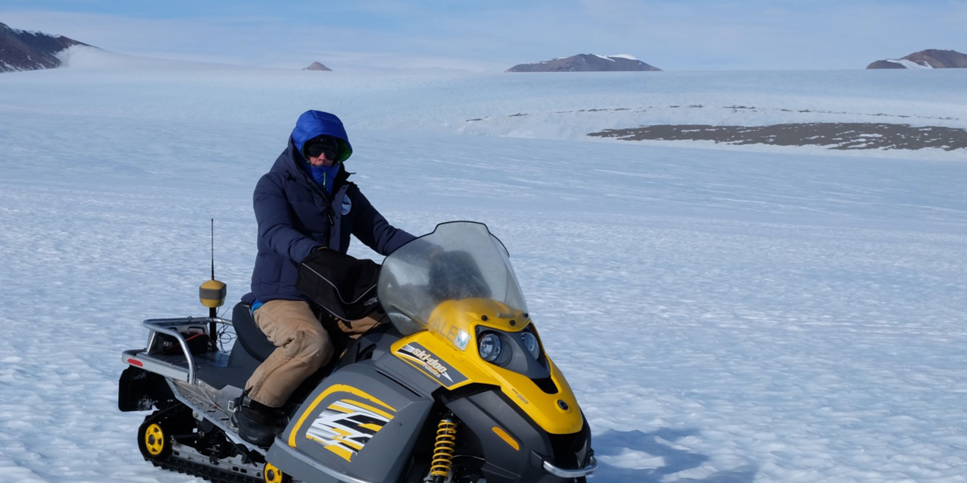
We used the GNSS to survey the ice fields, not just the proposed runway area, but the surrounding mountain peaks, to ensure we could gather enough data to position the runway in the best location. Knowing that a lot of ground needed to be covered quickly and effectively, we mounted the GNSS to skidoos. It proved useful having the Bing map background on the field controllers fixed to skidoos to help us orientate ourselves on the glacier – especially when the seemingly clear vistas lured you into a false sense of security when it came to measuring mountains. Distances and visibility of mountain peaks distorted judgment and they appeared much closer than they really were.
Alongside the survey we also erected an impressive ALE weather station which will remain on the continent, gathering and transmitting live meteorological data over the next 12 months. Once we had completed the installation in the ice, we headed back to Union Glacier Camp to begin packing up our homes for the last few weeks.
I’m now back in (slightly) warmer climes and so proud to be taking part in this project, there were parts of the expedition where I questioned if I was even physically fit enough – the 24hr daylight and non-stop action really does take its toll on you especially in such an unforgiving environment. But, I learnt a lot about how our technology works in such extreme climates. We’ll also be continuing analysis on all of the data gathered from the weather station over the next 12 months and move on to the next stage to certification and then preparation of the Ice to establish the runway.